
Congratulations on a job well done ! For a week you all worked as a great team, observing and recording the weather in your area and showing how the sum of all those observations can lead to a pretty clear picture of the weather across the whole US. Your data even allowed me to create the weather summaries you'll read below.
So, here are plots of all your weather data along with actual satellite images and weather maps for each of the five days from April 15 through 19 as supplied to PTK by The Weather Channel. As you can see, the weather observations you made and the data you sent in corresponds well with the "official" data for these days.
I hope you all enjoyed this activity and enjoyed seeing how weather observation and forecasting requires a team effort. You were all part of a great team and again congratulations !
Monday, April 15
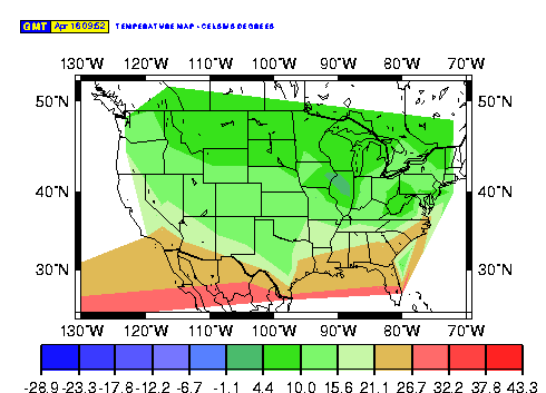
Meanwhile, the counterclockwise flow of air around the low over the
Great Lakes brought warm air as far north as Ohio and Virginia and also
cold air down into the western Great Lakes and northern plains. (See
your temperature
data)
Temperatures over the Great lakes continue cool on northerly winds
behind the low but a warming trend is occurring on the western side of
the high (because of mostly southerly winds) across the high plains.
(See the
temperature map)
Meanwhile, the center of the high pressure system that was over east
Texas and Louisiana yesterday has slid eastward to Florida and clockwise
winds off the back side of the high are spreading warm air as far north
as North Dakota. We might expect these warmer temperatures to push
eastward tomorrow. (Again, you can see all this from your cloud cover and
temperature
data)
Meanwhile, the low that came in off the Pacific yesterday has
redeveloped over Utah. The result is mostly cloudy skies and scattered
rain and snow showers over the northwestern part of the country again
today. A low in the northern plains is pushing into the western Great
Lakes and also producing showers there.
Sunny skies are found over the southwest along with warm
temperatures.
Meanwhile, high pressure still anchored off the east coast continues to
pump warm air up from the Gulf of Mexico into the eastern portion of the
nation for a real touch of spring while a cool, Canadian high pressure
system is sinking southward over Idaho, Utah and Nevada and bringing
cooler air along with it into the intermountain west.
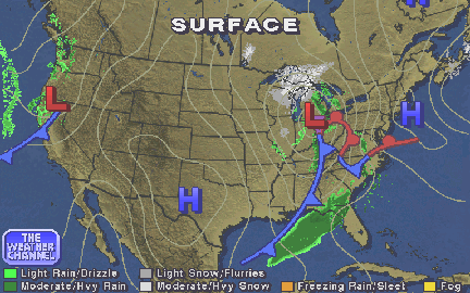
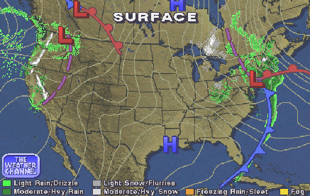
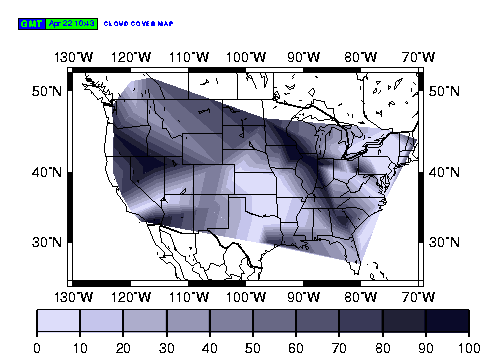
A low pressure system over the Great Lakes brought clouds and showers
to much of the eastern third of the US while a cold front moving in from the
Pacific did the same for the Pacific Northwest. In between, high
pressure over Texas produced mostly sunny skies from the Rockies and the
southwestern deserts eastward to the plains. The low and its cloud
cover over the eastern US is about 1200 miles by 700 miles in size but
that's tiny compared to some storms in the atmospheres of planets like
Jupiter, Uranus and Neptune. (See your cloud cover chart and
the weather map)
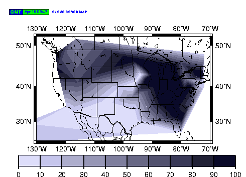
Tuesday, April 16
The low pressure system and fronts that were over the Great Lakes and
Ohio Valley yesterday have moved eastward but lots of clouds remain over the
Great Lakes and have spread eastward with the low into New England along
with rain and snow showers. The low out west is also moving east but
continues to create showers in the northwest and even snow at higher
altitudes. Meanwhile, high pressure along with sunny skies continues
from the eastern Rockies to the northern plains and has spread over the
southeast. (See the cloud
cover chart and weather map)
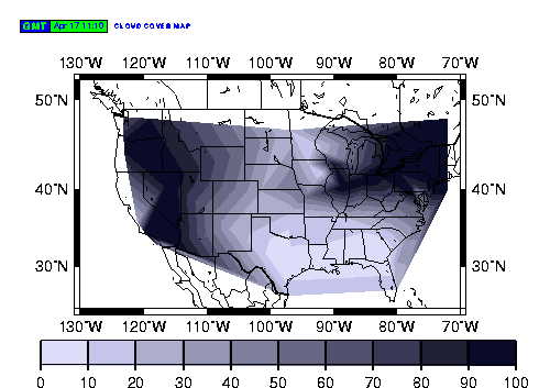
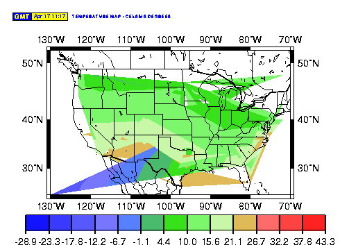
Wednesday, April 17
The eastern low pressure system continues anchored just west of
Maine and continues to bring cloudy and chilly weather to the Great Lakes
and New England. Can this be spring? Meanwhile, a new low pressure
system and front are beginning to move on to the west coast from the
Pacific and bring ocean moisture in the form of clouds and showers on to
the west coast. In addition, they are combining with another low over
Wyoming to continue mostly cloudy conditions over the western quarter of
the US. As the Pacific low moves east tomorrow, cloudy conditions might
be expected to continue over the northwest.
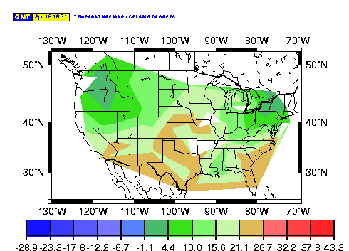
Thursday, April 18
Clockwise winds off the back side of high pressure which has now slid
off the southeast coast have finally pushed warmer air and sunny skies
northward to the Middle Atlantic States. (See cloud and
temperature
data)
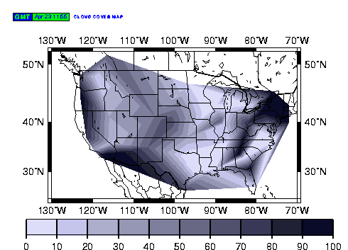
Friday, April 19
The low pressure center that was over the northern plains yesterday has
indeed moved eastward into the western Great Lakes today along with its
clouds and showers. Yet another low and front approaching the Pacific
northwest coast are bringing more clouds and showers from Washington
State down to northern California as a rainy week continues there.
And that's our look at the week's weather -- thanks to all you Weather
Watchers !! Those who wish to can measure the change in position of some
of the features on this week's weather maps and calculate their speed .
Then compare these speeds to the speeds you calculated for the faster jet
streams on Jupiter in the activity in the Teacher's Guide. How do these
compare with some jet streams on Neptune that have been clocked at over
1000 miles per hour ? How fast would our weather maps change if we had
such winds propelling storms on earth ?
Return to Weather Activity Results.

![]()